
Types of weather radar
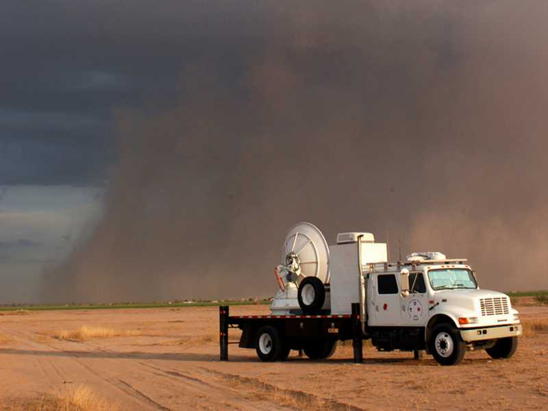
Figure 1: Smart-R (Doppler radar On Wheels, DOW) observes a sandstorm
Types of weather radar
Weather radars can generally be divided into fixed-site and mobile systems, although a distinction must be made between mobile and transportable equipment. In this context, a radar is considered mobile only if it operates while moving, as is the case with weather radar aboard aircraft or satellites. Even highly transportable radars, such as the Doppler radar On Wheels (DOW) systems used for tornado research in the United States, are not mobile in this sense: they operate from a fixed position.
Weather radars are usually highly specialized for a specific task. They operate in a frequency range between 2.7 and 100 GHz. Depending on the application, their transmitted power may range from a few tens of kilowatts to one megawatt. This power is often generated by a magnetron or a klystron. Semiconductor transmitters can also be used, but their necessary pulse compression usually reduces measurement accuracy, especially because of its time sidelobes. The time sidelobes from one range cell overlap the echoes of neighboring cells. At the same time, the echo in the range cell under consideration is affected by sidelobes from adjacent cells. Depending on their relative phases, these contributions can either increase or decrease the measured echo amplitude. The polarization can often be switched between horizontal and vertical linear polarization, or both polarizations are used simultaneously. In the latter case, the term STAR mode (Simultaneous Transmission And Reception) is often used. The receivers of weather radars usually require a dynamic range of more than 100 dB. This can be achieved by operating several receivers with different sensitivities in parallel. If one receiver is saturated, the signal from a less sensitive receiver is used, and its amplitude is adjusted in software to account for the overall receiver sensitivity.
The following types of weather radar can be distinguished according to their application:
- Precipitation radar, also informally called rain radar (although hail and snow are also precipitation, not rain), is a three-dimensional scanning radar. It is the most common type of weather radar and, depending on its application, operates either in S band or in C band. The X band is also used, but only for short ranges.
- Cloud radar mainly uses the K band or the W band.
- The antennas of
wind profilers
are located on the ground and point vertically upward, with slight changes in direction if necessary,
to measure wind speeds.
Their radar display shows changes over time.
- Mesosphere-Stratosphere-Troposphere (MST) radar is a so-called clear-air Doppler radar that uses low frequencies to measure the heights of boundaries between air masses of different densities.
- Temperature profilers (RASS) measure temperatures indirectly at high altitudes. They are used to determine vertical temperature profiles, temperature changes and inversion layers.
- Weather radar in avionics,
also called nose radar, is usually an
X band
multifunction radar for navigation and collision avoidance (and, in military applications, fire control),
combined with a weather channel operating as a precipitation radar.
It scans a sector in the direction of flight, displaying precipitation areas in real time as colored regions,
while other aircraft appear as bright symbols.
- A complementary method of meteorological remote sensing uses so-called microwave sounders. These passive microwave radiometers are used, for example, aboard weather satellites. They measure the atmosphere's natural microwave radiation in different frequency channels. These measurements can be used to derive vertical temperature and humidity profiles. Because microwave sounders neither emit electromagnetic waves of their own nor permit range measurements, they are not radar systems.
- …