Doppler radar products
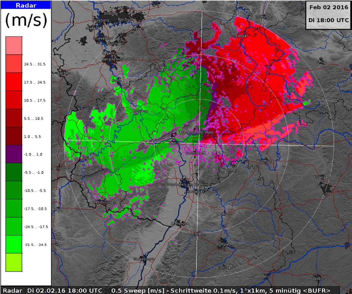
Figure 1: PR Site product, (Source: www.dwd.de)

Doppler radar products
Every Doppler radar can measure wind speeds. These are either fully coherent radars (with a semiconductor transmitter or equipped with klystron) or pseudo-coherent radars (with magnetron). For the measurement, the phases of two or more pulse periods are compared with each other (Pulse-Pair Processing). Most radars need at least some reflecting objects (raindrops, insects) moving with wind speed to measure a Doppler frequency. Only a few, very specialized radars with usually very high carrier frequencies can also measure radial speed of dry air (Clear-Air-Echoes).
Velocity–Azimuth Display
A velocity-azimuth display (VAD) can be generated as a composite from the volume scan of a precipitation radar. The display is similar to a CAPPI but shows the radial velocities of these reflectivities instead of the reflectivities. On this display, the local wind speed and direction, the horizontal extension of wind fields, their horizontal deformation, and the general direction of the weather phenomenon can be read.
The so called “basic speed” is the average radial speed of the reflecting objects at a given location. The radial velocity is the component of the movement of the target in the direction of the radar beam. Positive values (warm colors, red to magenta) indicate outwardly directed velocities, which are directed away from the radar. Negative values (cold colors, blue or green) denote inwardly directed velocities that are directed towards the radar.
The display can show the radial speed of the wind above ground or it can be calculated concerning the direction of movement of the weather phenomenon (for example a thunderstorm front). Thus the internal flows within the thundercloud can be recognized better.

Figure 2: Vertical wind profile as a function of time

Figure 2: Vertical wind profile as a function of time
(Source:
National Oceanic and Atmospheric Administration, USA)
Vertical Wind Profile
A vertical wind profile can also be calculated from the volume scan of a precipitation radar. However, this profile assumes that the wind movements are approximately uniform, i.e., no minor turbulence or wind shear occurs. Such more accurate wind profiles can only be created by specialized wind profilers.
Vertical wind profiles can enable a hail forecast by detecting strong updrafts up to high altitudes. The fact that big raindrops move to high altitudes with freezing temperatures causes hail.