Types of weather radar
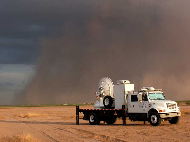
Figure 1: Smart-R (Doppler radar On Wheels, DOW) observes a sandstorm
Types of weather radar
Weather radar can generally be divided into radar sets with a fixed location and mobile radar sets, whereby here the fine difference between mobile and transportable must be considered. Mobile systems are only those devices that are in operation during a movement, for example, weather radar in an airplane or satellite. Even highly transportable radars, such as those used in the USA to monitor tornadoes, are not mobile, because they have a fixed location during operation.
Weather radars are usually highly specialized to perform a precisely defined task. They use a frequency range between 2.7 and 100 GHz. Their transmitted power can vary between a few tens of kilowatts and one megawatt, depending on the task. This power is often generated by either a magnetron or a klystron. Semiconductor transmitters are also possible, but because of the necessary pulse compression (especially because of their time sidelobes), they usually have a worse accuracy of the measurement results. The polarization is often switchable between linear horizontal or linear vertical or both polarizations are used simultaneously. Then the term STAR Modus (Simultaneous Transmission And Reception) is often used. The receivers of weather radars require a dynamic range of usually more than 100 dB. This is technically realized by using several receivers with different sensitivity in parallel. If one receiver is saturated, the echo signal from the less sensitive receiver is used.
There are following weather radar types depending on the task:
- Precipitation Radar (PR), also called Rain Radar (however, hail or snow is precipitation, but is not rain) is a 3D- omnidirectional radar. It is the most common type of weather radar, which operates either in S-band or in C-band, depending on the application. The X-band is also used, but only for short ranges.
- Cloud Radar mainly uses the K-band or the W-band.
- The antenna of the
Wind Profilers
lie flat on the ground and radiate vertically upwards
with a slight variation of direction if necessary to measure wind speeds.
Their radar image is a function of time.
- Mesosphere-Stratosphere-Troposphere (MST) radar is a so-called clear-air Doppler radar and uses low frequencies to measure the height of boundary layers between air volumes of different density.
- Temperature profilers (RASS) indirectly measure temperatures at high altitudes. It is usable for vertical profiling of temperatures, temperature gradients, and detection of inversion layers.
- Avionics weather radar,
or nose radar, is usually an
X-band
multifunction radar for navigation and collision avoidance,
combined with a weather channel as a precipitation radar.
It operates in only one sector in flight direction, displays the precipitation areas in real-time as colored areas,
while other aircraft are displayed as white symbols.
- Microwave-Sounder are passive radiometer onboard of satellites, that measure simultaneously the radiance at up to 24 different frequencies between 23 and 230 GHz. The distribution of temperatures and humidity in different layers of the atmosphere can also be derived from this.
- …